GRCF Monitoring and Citizen Science Steart Marshes
The Green Recovery Challenge Fund (GRCF) running from March 2021 to 2022 has afforded WWT a valuable opportunity to support continued monitoring, research and citizen science engagement at WWT Steart Marshes.
Background
The Green Recovery Challenge Fund (GRCF) running from March 2021 to 2022 has afforded WWT a valuable opportunity to support continued monitoring, research and citizen science engagement at WWT Steart Marshes. As a managed realignment site, Steart Marshes has historically been a hotspot of monitoring and research. Scientific activities have been carried out by staff, students, volunteers and researchers and the engagement of volunteers and members of the public plays a vital role in facilitating this. Steart is an excellent place to study the effects of managed realignment on ecosystems because it provides a “living experiment” from which to test theories and hypotheses. A wide range of scientific data are now available both before the breach and after the breach, which has been vital for our understanding of how conditions on the reserve are changing as saltmarsh formation and succession progresses. In addition, there is much to knowledge to gain from investigating the role of Steart Marshes in sequestering carbon as part of our ongoing research into Blue Carbon in collaboration with Manchester Metropolitan University. The Conservation Evidence Department at WWT are also investigating ways in which wetlands such as Steart offer multiple benefits to people and wildlife, with particular emphasis on the value of the freshwater component of the reserve. A number of habitat improvement works were set to be carried out under the GRCF project and a key monitoring aim was to generate baseline ecological data in the summer before the works began. This would allow the original baseline data to be compared with future data from ongoing monitoring and evidence carried out after the new habitats establish.
Collating Evidence
Prior to GRCF, a vast amount of ecological data had already been collected by staff and volunteers as well as several partners and collaborators, often under multiple projects or via established long-term monitoring. This means that while numerous reports were generated from survey and monitoring results, the data in many cases was not yet collated onto a central system. The funding from GRCF enabled us to address this gap by supporting Dr Sarah Davies from the Wetland Science team to undertake a systematic review of the research and monitoring carried out at Steart from before the breach in 2014 to the end of 2020. The task served to provide an overview of existing data and highlight suggestions for future analysis and potential publications. Sarah was able to identify the main knowledge and/or research gaps at Steart which could provide direction and focus for future monitoring and research efforts. The outputs were presented as an internal report for staff and volunteers at Steart detailing the existing and current work carried out and highlighting future opportunities. In addition, an up-to-date spreadsheet of collated information was created to describe and document past and current monitoring, and a second spreadsheet documented all known research projects carried out by partnered universities, with links to any reports or publications. Sarah presented a summary of some of the main findings, data gaps and future opportunities at the Steart Research Day in August 2021.
Monitoring and research carried out under GRCF
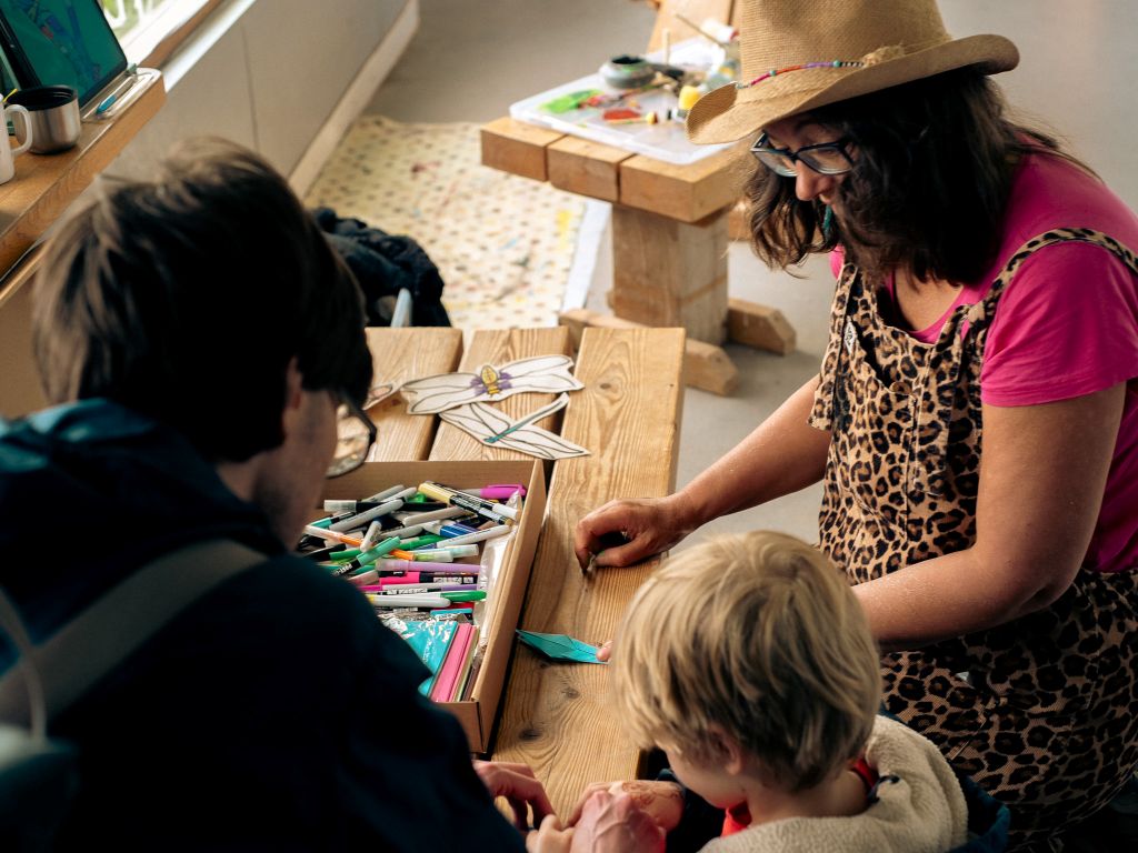
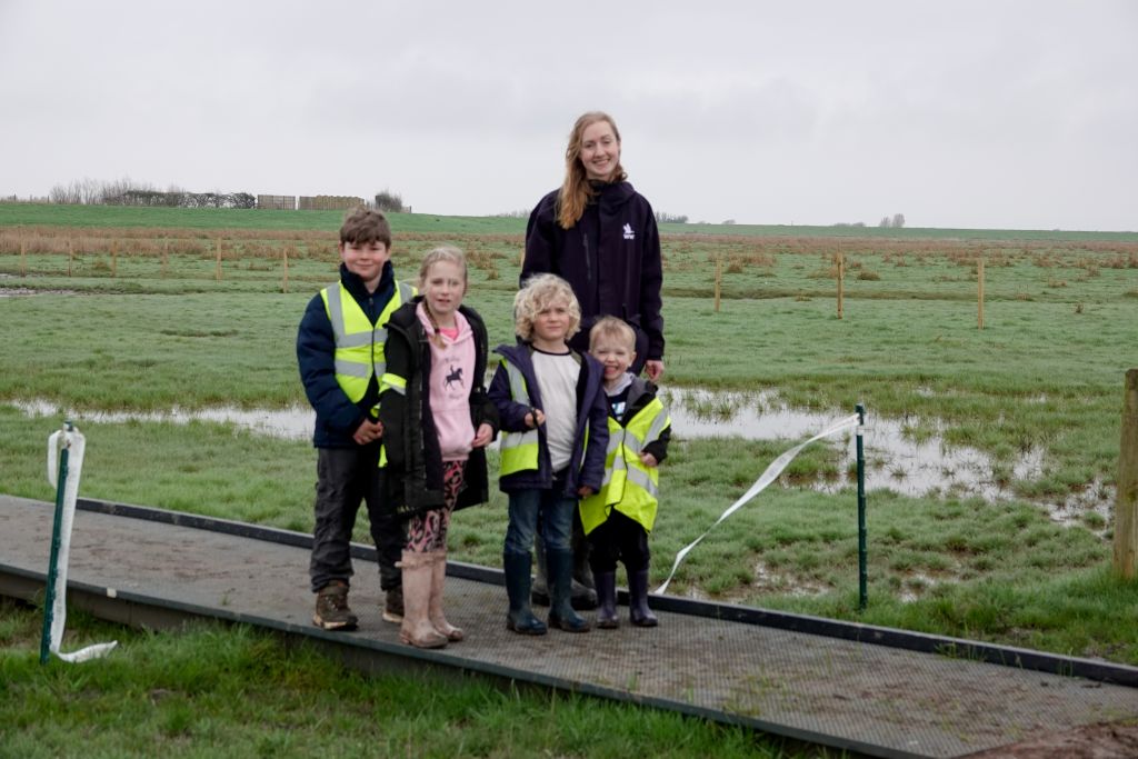
Over summer and autumn 2021 the Wetland Science Team were involved in data collection across the reserve to meet the objectives set out by GRCF. This work was made possible with the invaluable help of reserves staff, volunteers and citizen scientists. The team ran a number of training sessions for the monitoring activities and these were well attended by both existing volunteers and members of the public. As a result, several new volunteers signed up to continue to monitor the site and we are currently planning a strategy to continue the legacy of GRCF via ongoing engagement and support.
Emerging Insects at Ponds
In June 2021 we piloted a method for surveying emerging insects at ponds in Stockland Marshes. This pilot was used to inform the development and design of the Wetland Science Team’s study for the farming and pondscape elements of GRCF. One of the tasks within this was the measure the “aquatic subsidy” provided by a pond, i.e., the insects that develop in pond habitats and their benefit to terrestrial wildlife. We also aimed to test the effectiveness of two different types of emergence traps which we were planning on using in the final study. Volunteers were trained in the use of these emergence traps and assisted with setting up both traps in one of the ponds in Stockland Marshes. The following day we collected the captured invertebrates, counted the numbers from each trap and identified the insects. We discovered that both traps captured a similar number and diversity of invertebrates meaning that they could be used together in the same study. This pilot was really valuable for helping us to make the final design tweaks needed to successfully carry out our emergence study at different farms in Somerset in July 2021.

Ditch Surveys
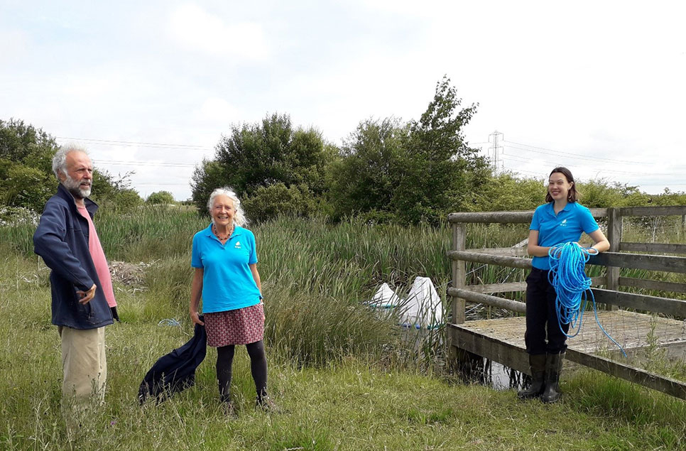
We aimed to kick-start a monitoring programme of ditch invertebrate surveys at Steart Marshes, to supplement existing vegetation surveys and beetle surveys carried out by the ecological consultancy, Geckoella. The Wetland Science Team developed a ditch survey method based on existing guidance from Buglife that could be readily used in the field by volunteers or citizen scientists without specialist identification skills. The method provides an effective, yet quick and simple way of monitoring ditches without a great deal of resource - just a pond net, a tray, a magnifying glass and an identification guide. Ditch indicator invertebrate groups such as diving beetles, freshwater shrimp, mayflies, stoneflies, damselflies, aquatic hemipterans (water boatmen, pond skaters etc.) and caddisflies were chosen as the key focus of the surveys. We used a ditch scoring system similar to that used by the OPAL Pond Health scoring tool to assess each ditch. Each invertebrate group was allocated a score from 1-10 depending on their potential as an indicator of good habitat quality or water quality. The score of each invertebrate target group present in a given ditch was then totalled to give a total score for the ditch surveyed. Our methodology was piloted during autumn ditch surveys at Steart across the site. The first of these survey days was run as a citizen science training session, where volunteers were taught the survey method in the field and were given the chance to test it themselves.
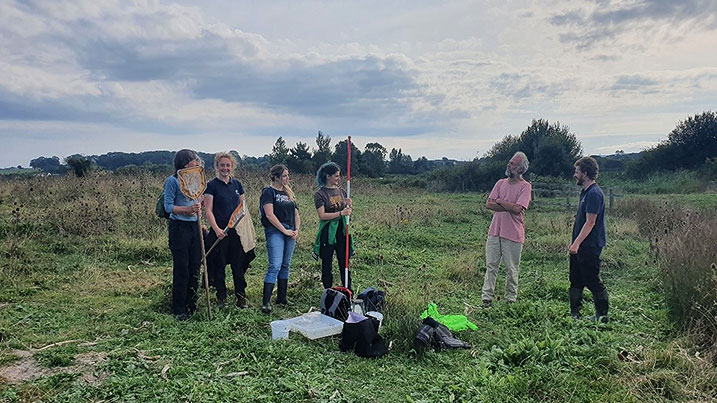
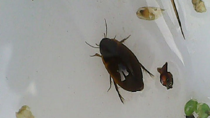
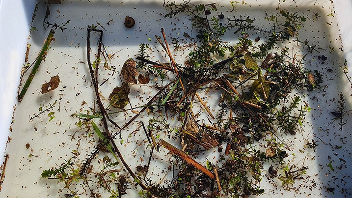
In October 2021, Sarah Davies and Lucy Smith carried out the ditch surveys with the assistance of Steart volunteers and Josh Butterworth from Geckoella. Twenty five ditches across the reserve were surveyed for invertebrates and assigned a ditch quality score. The ditches were split across Stockland Marshes (primarily freshwater ditches), Otterhampton Marsh (mix of freshwater and brackish ditches) and Steart Marshes (primarily brackish ditches). A subset of the ditches were sampled in more detail and we collected bulk samples for DNA analysis. qPCR analysis is currently being carried out to describe and quantify target insect groups by Laura Weldon at the Wetland Science Lab, and a smaller subset of samples are being sent off for DNA metabarcoding with the company Nature Metrics. These DNA techniques will enable us to identify the species present and compare the ditches in greater detail. We also incorporated the information on ditch vegetation communities collected by Geckoella, to give our findings context. So far, the results from our basic surveys have indicated that different invertebrate groups are found at the different parts of site, with the insect communities structured by both plant habitat quality, plant species richness and salinity. Most of the ditches were scored as “good”, and some “excellent”, meaning they provide adequate habitat and water quality for a wide variety of invertebrates.
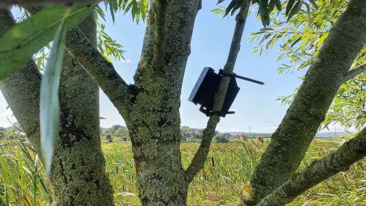
Bat and Soundscape Monitoring with AudioMoths
We collected soundscape and bat audio data in September and October 2021 using AudioMoth detectors. The detectors were deployed by Sarah Davies science and a team of trained volunteers. Three AudioMoths were set up in the three main areas of the reserve (Stockland, Otterhampton and Steart) to measure and compare the activity of bats at each location. Another three AudioMoths were set to record whole soundscapes at these same locations, enabling us to assess acoustic diversity indices – essentially measurements of how much wildlife sound activity is present across the reserve, indicating biodiversity.
We found that bat activity was high across the reserve with bat species using all three of the survey locations on each night. Activity for most bat species was greatest shortly after sunset and shortly before sunrise, coinciding with when bats are leaving their roosts to forage at dusk and returning again just before dawn. Several rare species were recorded such as greater and lesser horseshoe bats, Nathusius’ pipistrelle and Barbastelle. We also recorded many instances of more widespread species in Somerset such as Common pipistrelle, Soprano pipistrelle and Noctule. The freshwater areas of site at Stockland had the greatest amount of bat activity, but activity was nonetheless still higher than expected for the time of year at Otterhampton and Steart Marshes, areas which encompass brackish water and saltmarsh as well as freshwater. The soundscape data is currently being analysed by the Wetland Science Team.

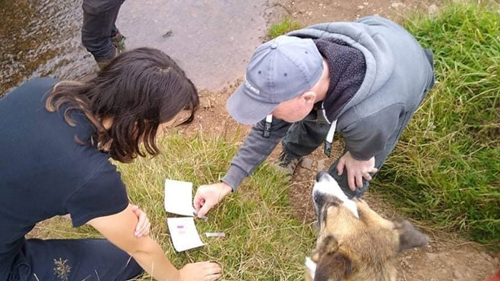
Eel eDNA Survey at Stockland Ponds
Laura Weldon from the Wetland Science Team has been developing eDNA techniques to detect species of conservation concern in wetlands. The GRCF project provided an excellent opportunity to test out her methods. One of our aims this year was to assess the permeability of Steart Marshes European eels travelling across the site. eDNA samples were collected from approximately ten ponds in Stockland Marshes during a citizen science training day in August 2021. Volunteers and members of the public were given initial training and then provided with a sampling kits which they used to collect and filter water samples from each pond. The DNA was preserved on the filters and the presence of eels in the water was later tested in the Wetland Science laboratory by PCR with eel-specific primers. The results of the study were used to generate a map of eel presence in the pond system and have since helped to develop eDNA methods for other species and aquatic systems.

Water Quality
In August, citizen scientists and Steart staff and volunteers were trained in how to carry out rapid water quality testing of the channels and brooks across site, using nitrate and phosphate colour change kits provided by FreshWater Watch. In addition they were shown how to take turbidity measurements (a measure of how “cloudy” or “clear” the water is) using a secci disk and a clear tube. Since then a volunteer has been collecting water quality data on a monthly basis on the reserve. The results should help to generate a longer-term picture of water quality as well as enable us to better identify any agricultural inputs to the water system and any peaks in nitrates and phosphates that might indicate a pollution event. In addition the number of twice-monthly water quality sampling points has been increased from two to six. The additional four sampling points are established at various points across the reserve, primarily along Middle Brook to include the inflow and outflow onto site. Once every two months a 500ml water sample is collected by volunteers from these locations. Water samples are sent to the Slimbridge Wetland Science laboratory for in depth water quality analysis. During the analysis the levels of nitrates, phosphates, ammonia and suspended solids from each sample are tested and evaluated.

Conclusion
The results of this year’s work under GRCF has emphasised the importance of wetland habitats and the value that the variety of habitats supported at Steart can provide to the wider landscape. We hope that continued monitoring will be able to expand upon our baseline findings and investigate longer-term changes, for example as a result of the habitat improvement works. It will be important to continue to engage with and support volunteers and citizen scientists in the wider community, as well as to continue to collaborate with existing and future partners in science and research, academia, wildlife conservation and ecological consultancy.