Droning on at WWT Caerlaverock
These days it feels like drones are that popular and ingrained in society that when people think of their uses they think of social media influencers, great ways of getting a different perspective of a scenic holiday location, or even delivery services. Along with these and many other uses, they can be incredibly useful in conservation. The gains we get from using drone footage are very varied, from great imagery that we can use in social media and project reporting, to showing work you have done and what might be useful to do next. We can record changes to land type and vegetation cover in the long term and even monitor species!
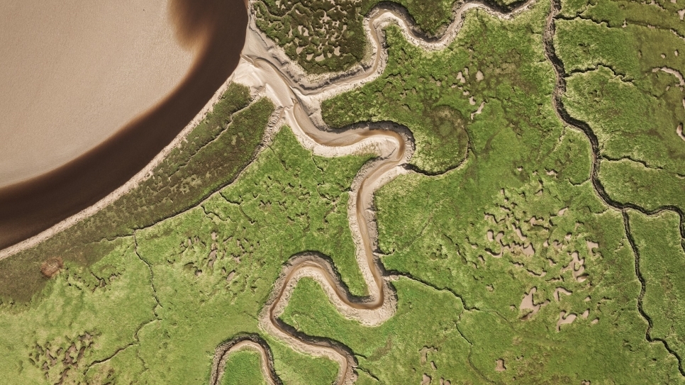
 Fresh wetland restoration through pools and channels. Picture by Tony Graham.
Since I started working on the Wilder, Wetter Caerlaverock project the importance of drones on the work that I do has become larger and larger. I’ve really enjoyed using them and seeing the reserve in a new way; it’s very exciting when you see the drone go up for the first time after some restoration work has been completed and you see what it all looks like from the live feed. The most obvious benefit is being able to view any work completed from above, using a different perspective to show how it’s benefiting the reserve, how it works in the wider landscape, and highlighting the difference with before and after shots from the working area. This is then something we can use to show our work to the public, and also our funders. Additionally, one of my favourite uses is to look at drone imagery to see areas that need further attention, an example would be the area where we’re clearing a percentage of gorse to open the area up for natterjack toads and other wildlife. By looking at the images I can see where denser blocks of gorse remain and should be targeted for next year’s work. We can also use images like this in areas we’re hoping to restore wet grassland as we can use the drone to get a view of how the fields are holding water and how the water might move around the environment.
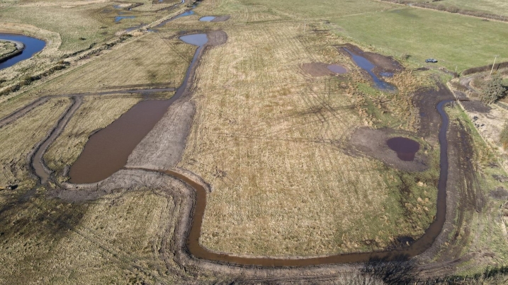
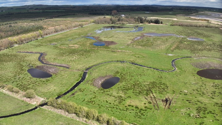 Fresh wetland restoration through pools and channels. Picture by Huw Connick.
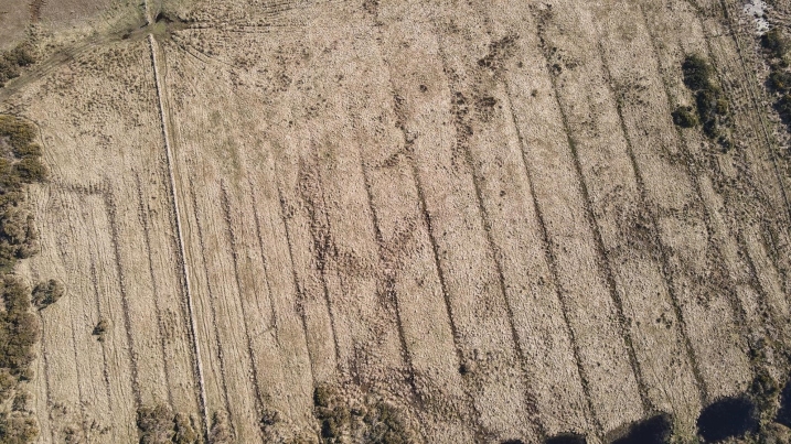
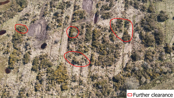 Showing level of scrub expansion and where big blocks of gorse remain that we can target for further clearance. Picture by Jake Goodwin.
They can also be very useful in tracking changes in the landscape over time. This can take many forms including habitat changes like vegetation type, cover and spread, grazing impact, weather changes over the long term as well as many other opportunities. For us at Caerlaverock we use this type of monitoring in a couple of ways. One thing we do regularly is something called fixed point photography which involves taking pictures from a designated location and direction at stated intervals. We take most of ours every three months and usually take them on a normal camera from our tower hides. However, we have created some new fixed point photography points that are drone-based shots as the perspective you get of the land is superior. Fixed point photography allows us to track how the reserve is changing over time which is incredibly useful and can even help us monitor the effects climate change has on a reserve like ours. As we’re a coastal site, sea level rise will affect our reserve. We’re already seeing this on high tides when the power of the tide crashes into the sea wall and breaks holes in it. We call these breaches. These breaches can change in size and form very quickly as they get battered by high tides and so we want to monitor there change over time. By taking pictures of these each year we can monitor their change. This year we were lucky enough to use a drone to give a slightly different view of how these breaches are changing.
 Long-term based monitoring of scrub expansion. Picture by Jake Goodwin.
Drones are significantly benefitting Caerlaverock, from enabling a new perspective to allowing us to track changes over time, they are a fast becoming a valuable conservation tool.
The Wilder, Wetter Caerlaverock project is supported by the Scottish Government’s Nature Restoration Fund, managed by NatureScot.
Words by Jake Goodwin
Cover picture by Ted Leeming