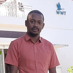
Valisoa Fifaliana Rajoelinirina
Senior Project officer, GIS and Data Management (Madagascar)

About me
After completing my Master’s degree, I worked as a GIS consultant with several consulting organizations, including Geo-Space Madagascar, where I contributed to the VONONA project (hydrological studies and digital mapping of flood-prone areas), as well as the recent update of Madagascar’s Disaster Risk Atlas. I also collaborated with the association Agir pour le Sud (AS) on a project focused on landscape and forest restoration in the communes targeted by Programme de Lutte Anti-Erosive (PLAE) and took part in an environmental and social impact assessment for the installation of a cement grinding station, in partnership with another independent consultant.
My role
I work as a GIS specialist and database manager at WWT Madagascar. My main mission is to support the development of a portal dedicated to wetlands, ensuring it contains complete, and up-to-date data on Madagascar’s wetlands. I also contribute to the success of the WWT Madagascar Program in mapping using remote sensing and in data management.
Experience and interests
- GIS and remote sensing
- Monitoring and early warning of droughts via remote sensing
- Study of the effects of climate change on hydrology and marine ecosystems